National weather highlights for Nov. 5, 2026. Forecast snapshot reviewed at midday Eastern time; linked agency pages update throughout the day.
A changing national picture
Thursday brings a divided weather picture across the United States: rain advancing toward the Atlantic Coast, floodwater lingering in Florida and another windy stretch approaching the Pacific Northwest. The immediate concern depends on location. A quieter sky does not mean a flooded river has become safe, while a relatively dry afternoon in Washington can precede stronger overnight winds. These highlights describe forecasts and ongoing hazards reported by the National Weather Service on Nov. 5, rather than conditions at every address.
The Weather Prediction Center’s early Thursday outlook places showers and thunderstorms along an eastward-moving cold front. The agency expects broader rainfall coverage in parts of the Northeast and New England on Friday, with isolated to scattered flash flooding possible. It also flags increasing thunderstorm activity near South Texas as the front’s southern end remains a focus for moisture heading toward the weekend. Travelers should treat this as a developing forecast and check local timing before departure.
Florida: Less rain, persistent danger
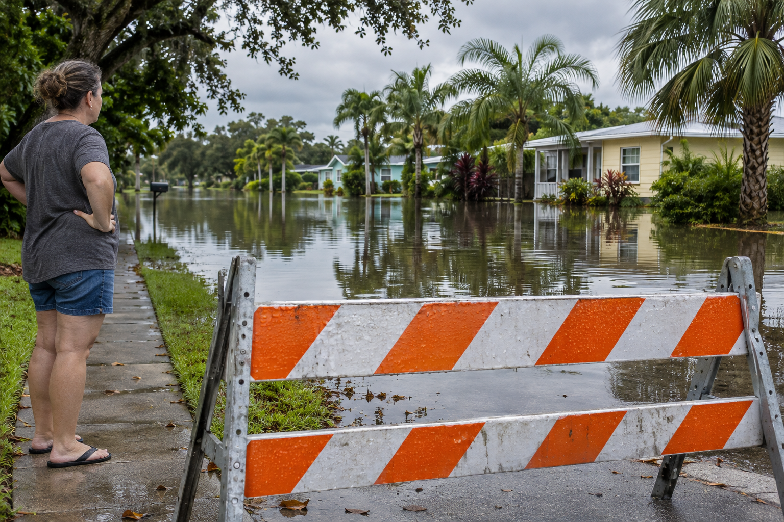
In east-central Florida, the recovery story is already underway. The Melbourne forecast office reports catastrophic flooding affecting southern Brevard County and the Treasure Coast, while forecasting mostly dry weather through late week. That combination matters: rainfall can ease over a neighborhood even as runoff elsewhere continues moving through a river system. Standing water and closed access roads remain hazards after the clouds break.
Melbourne’s Thursday hydrology discussion says flood warnings cover St. Johns River forecast points at Cocoa, Geneva, Sanford, DeLand and Astor. River levels are forecast to rise slowly over several days. Cocoa is projected to reach major flood stage later this week, with Geneva approaching that threshold early next week. Those are forecasts, not a statement that both locations have already reached those levels. Follow the latest river forecasts and local emergency instructions before returning to affected property.
Source: NWS Melbourne discussion — 6:29 a.m. EST Nov. 5; hydrology issued 2:30 a.m..
Northwest: Prepare before the wind arrives
Western Washington has a different timeline. The Seattle forecast office expects a relatively dry Thursday afternoon, followed by increasing southerly winds overnight into Friday. Its early morning discussion identifies the coast and northern interior, particularly north of Everett, as the favored areas for gusts reaching 40 to 50 mph. Wind advisories are in effect for specified coastal and northern communities; the exact coverage and expiration times should be checked locally.
The office forecasts another windy period Saturday evening into early Sunday. Rain arrives unevenly: the Olympic Peninsula and areas near the Canadian border are favored earlier, with Seattle’s main rain expected later Friday. Forecasters do not anticipate river flooding during the next seven days in this discussion, but repeated storms can wet soils and raise river flows. That outlook supports preparation for changing conditions without assuming an immediate regional flood emergency.
Source: NWS Seattle discussion — 2:20 a.m. PST Nov. 5.
Puerto Rico: Repeated downpours deserve attention
Puerto Rico also warrants attention in a national briefing. The San Juan office expects afternoon showers and thunderstorms over the interior and northeastern portions of the island, potentially extending toward St. Thomas and St. John. Its Thursday discussion highlights urban and small-stream flooding, possible isolated flash flooding, rapidly rising waterways and landslides where rainfall persists. Saturated ground and slow-moving storms can make additional rain consequential even when activity is uneven across nearby communities.
The forecast maintains a moist pattern through Saturday. Residents and visitors should watch for updated warnings during afternoon plans, especially near streams and steep slopes. A separate northerly swell is expected to increase rip-current risk this weekend along northern Puerto Rico, Culebra and St. Thomas. A break in rainfall does not establish safe beach conditions; beach hazards and inland flooding require separate checks.
Source: NWS San Juan discussion — 2:30 a.m. AST Nov. 5.
Practical decisions for today
Across the Plains and Midwest, reinforcing fronts are forecast to bring cooler-than-average air southward, while unusually mild conditions continue farther east for another day or two. The national pattern therefore calls for regional decisions: watch rainfall timing in the East, prepare for Washington winds and respect lingering Florida flooding. None of these broad summaries replaces a current warning for a specific town.
Before driving, review the latest forecast, road closures and river information for the entire route. Never drive around a flood barricade or walk into floodwater. Water can conceal a damaged road, and depth is difficult to judge from a vehicle. Keep alternative routes available, allow extra time and postpone a trip when the safe route is uncertain. For households and businesses, use the quieter hours to confirm contact numbers and decide who will monitor alerts. Match the plan to the hazard: an outdoor appointment, a coastal trip and access to a flooded building present different questions. Make the next decision from the latest local information, then share that decision clearly with everyone who needs it.
Source: NWS flood safety.